Maps & Environment Management
utiLITI provides robust map authoring and management features supporting standard TMX formats while adding LITIENGINE-specific environment properties like ambient lighting, shadow tinting, and ID synchronization.
1. Creating a New Map
- Select Map -> New... from the menu or press
Ctrl + Shift + N. - In the New Map Dialog:
- Name: Unique internal map identifier.
- Width & Height: Map size in tile units.
- Tile Width & Tile Height: Grid cell pixel dimensions (e.g.
16x16,32x32). - Click Create to initialize the map and add it to your project bundle.
2. Importing & Exporting Maps
Importing Maps
- Map -> Import...: Browse and import one or more
.tmxmap files into your project. - utiLITI imports all tile layers, object layers, and external tileset references directly into
.litidata.
Exporting Maps
- Map -> Export...: Export the active map back into a standalone
.tmxfile for use in external tools like Tiled.
3. Map Properties & Atmospheric Lighting
Select the map background or choose Map Properties in the inspector to configure environment-wide settings:
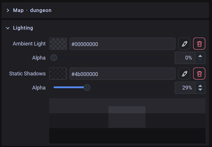 Map Properties panel showing map metadata, ambient lighting color and alpha, and static shadow controls.
- Map Name & Title: Internal identifier and user-facing title.
- Ambient Light Color: Color picker and alpha opacity slider determining global environmental darkness. When ambient alpha is greater than 0, dark levels require
LightSourceentities for visibility. - Static Shadow Color: Tint and darkness level for all static shadow casters on the map.
- Ambient Preview Panel: Live interactive swatch demonstrating the lighting composite in real-time.
4. Map Snapshots & Maintenance Tools
- Save Map Snapshot (
Shift + PrintScreen): Renders the entire full-resolution map canvas to a PNG image file—ideal for level overviews, mini-maps, or documentation. - Sync Maps: When Map -> Sync Maps is checked, external modifications to
.tmxfiles on disk are automatically detected and reloaded into utiLITI. - Reassign Map IDs: Opens Map -> Reassign Map IDs... to re-index all entity IDs starting from a specified minimum integer, resolving ID collisions across merged levels.
- Delete Map: Removes the selected map from the project bundle.